webmaster
user's content
click to ADD a new story/article | property
| Title | Image | Body |
|---|---|---|
| Proposed High Street Lowestoft Post Office Move | 
|
[UPDATED 17/12 disappointingly Post Office Ltd IS going ahead with the move] It has been brought to our attention as a community group (MECG) that the High Street post office (the most easterly pos / 17 December, 2024 |
| 20 High Street |  ,
, 

|
In the 17th century [Nos. 33 occupied the cleared ground-space of former Nos. 19-20 High Street.] - full list here / The Town Green was originally a northward extension of the High Street but the space on which the green now stands was created out of property destruction and damage caused by WW2 air raids, and on / 17 December, 2024 |
| 19 High Street |  ,
, 

|
In the 17th century [Nos. 33 occupied the cleared ground-space of former Nos. 19-20 High Street.] - full list here / The Town Green was originally a northward extension of the High Street but the space on which the green now stands was created out of property destruction and damage caused by WW2 air raids, and on / 17 December, 2024 |
| 16 High Street |  ,
, 
 ,
, 
|
12 May 1943, 2100 hours. Some 25 FW 190s, each carrying a single 500 kg HE bomb, swept across the town at 50 ft causing death and destruction on a dreadful scale. 4 bombs in High Street caused very serious damage to cottages and property in the area pictured. CREDIT: Bob Collis / The Town Green was originally a northward extension of the High Street but the space on which the green now stands was created out of property destruction and damage caused by WW2 air raids, and on / 17 December, 2024 |
| 15 High Street |  ,
, 

|
In 1841 this was described in the Tithe Apportionment as being a “house and garden” owned and occupied by a Lowestoft-born, 45 year-old widow, Elizabeth Curtis. Elizabeth also owned land to the east of her garden stretching down to Whapload Road. This was used as a “twine ground” and occupied by a twine-spinner named William Masterson. / The Town Green was originally a northward extension of the High Street but the space on which the green now stands was created out of property destruction and damage caused by WW2 air raids, and on / 16 December, 2024 |
| Park Terrace | 
 ,
, 
|
Trees and across the road Parkholme Terrace - still there today / OurFallen casualty William Turrell lived near here / 15 December, 2024 |
| XANADU BAR. | 
|
DRY COCKTAILSMANHATTAN / MARTINI COCKTAILVODKATINI / AMERICANOKIRROYALMEDIUM SWEET COCKTAILSTEQUILA SUNRISECUBA LIBRE / MAI TAIBLACK RUSSIAN / 15 December, 2024 |
| Lemon Drop Martini | 
|
Ingredients135 ml /1 ½ oz gin45 ml / ½ oz triple sec45 ml / ½ oz lemon juice freshly squeezed0.75 tsp / 15 December, 2024 |
| Pegu Club cocktail | 
|
Ingredients6 ounce* gin3 ounce orange liqueur (triple sec, / 15 December, 2024 |
| 14 High Street |  ,
, 

|
In 1841 the property was own by Caroline M. Hubert and Harriet Smith. Described as being a “House & Garden” it was connected by a narrow reserved right of way which connected it to Whapload Road – this was shared with No. 15 to the immediate south. / The Town Green was originally a northward extension of the High Street but the space on which the green now stands was created out of property destruction and damage caused by WW2 air raids, and on / 15 December, 2024 |
| 133 High Street |  ,
, 

|
In 1865 No133 was a butcher's shop run by William Rackham who also had a branch in Kirkley but by the time the 2nd picture was taken in the 1880's it had passed to Benjamin Saunders and Sons. The shop continued as a butcher's well into the 1960's until it became the Go-Go's Coffee Bar and Cafe but by the time the 3rd picture was taken the shop had become J and M Cards. / Madeleine and John welcome you to an interesting world of furniture and curiosities / 13 December, 2024 |
| 12 High Street |  ,
, 

|
No12 in 1865 was Mrs Mary Hunt, Lodging House. At 12 High Street we have William Roll and family - marine store dealer and a boarder:Revd Cyril Herbert Harvey - clerk in Holy Orders CREDIT: 1911 censusSee also Lost End of High St———————— / The Town Green was originally a northward extension of the High Street but the space on which the green now stands was created out of property destruction and damage caused by WW2 air raids, and on / 13 December, 2024 |
| 11 High Street |  ,
, 

|
No11 was always a private house. See also Lost End of High St——————- / The Town Green was originally a northward extension of the High Street but the space on which the green now stands was created out of property destruction and damage caused by WW2 air raids, and on / 12 December, 2024 |
| 8 High Street |  ,
, 

|
No. 8 High Street seems to have been created, probably in the early 1800s, by sub-dividing a larger house into 3 smaller units. No. 8 only contained 4 main rooms. In the 1950s it was incorporated into the adjacent No. 7 High Street. Together with the adjacent buildings it was demolished in the 1960s when the cliff top garden to the south was extended. / The Town Green was originally a northward extension of the High Street but the space on which the green now stands was created out of property destruction and damage caused by WW2 air raids, and on / 11 December, 2024 |
| 7 High Street | 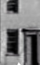 ,
, 
 ,
, 
|
This photo taken in the late 1940s or early 1950s shows Nos. 7 to 10 High Street not long before they were demolished. The vacant lot next to No. 7 is the site of No. 6 which has already been demolished. When the 1911 census was taken it contained 5 rooms and was occupied by a fisherman named William Boggis with his wife, Frances, and their four young children. / The Town Green was originally a northward extension of the High Street but the space on which the green now stands was created out of property destruction and damage caused by WW2 air raids, and on / 11 December, 2024 |